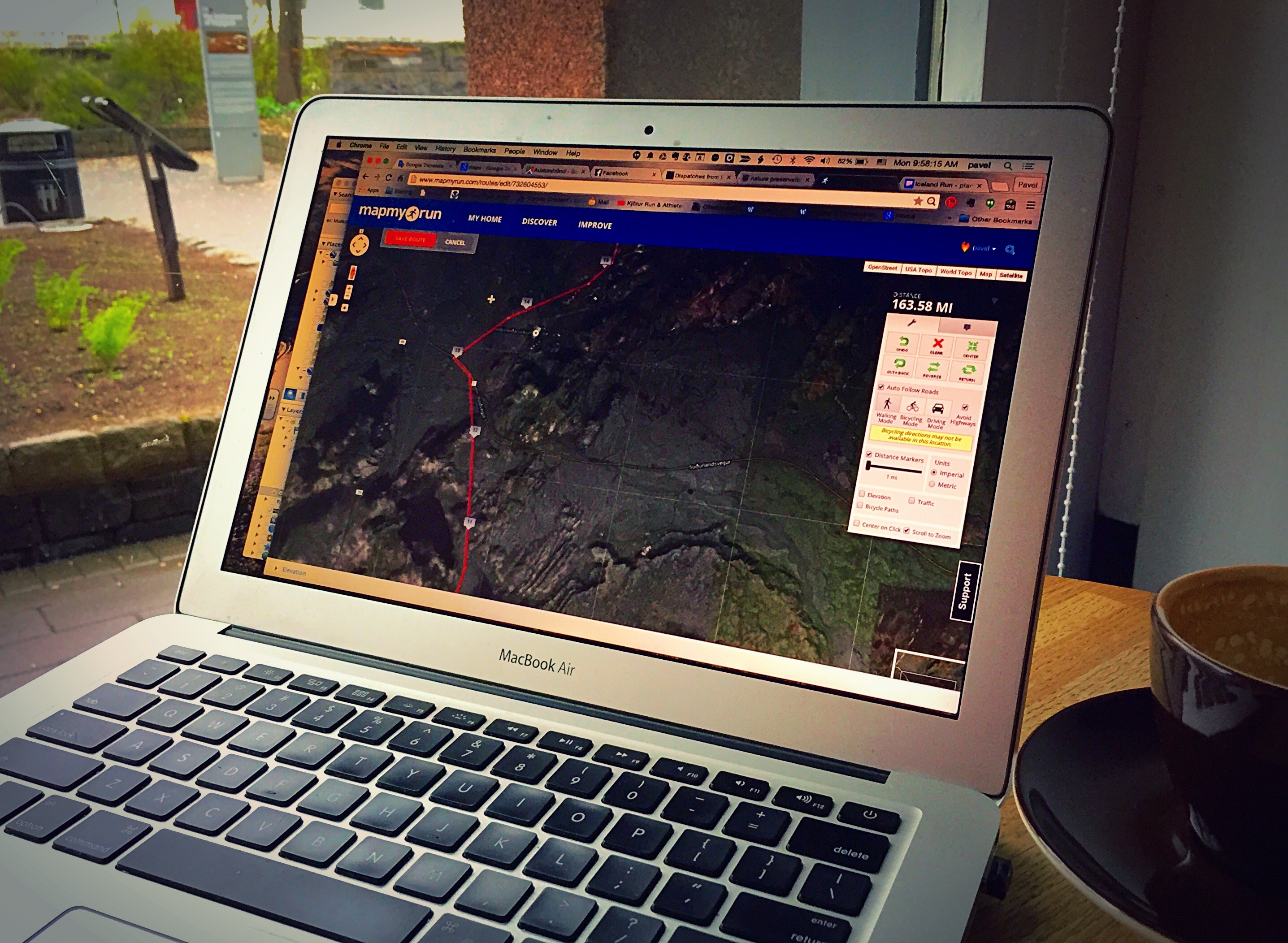
With only a week before the run, I spent much of this cold and rainy morning in a café across the square from the glass portal into the 871 Settlement Museum’s subterranean exhibit. Over a coffee and croissant, I counted miles, identified road crossings, and talked with family members and friends due to arrive in Iceland later this week.
The new route measures about 164 miles on the map, although I sense that some of the trail miles in the mountainous terrain around the 803 meter high volcano, Hengill, will be a bit longer than the map lets on.
Most of our route-finding forays have been in the first 35 mile stretch; 130 miles will likely remain unknown to me until I get there next week. That said, the first sections are the most complicated with regard to route finding–mixing beach, gravel road, horse path, hiking trail, and pavement. I have set up 3 aid stations in that section where roads intersect with the route of the run.
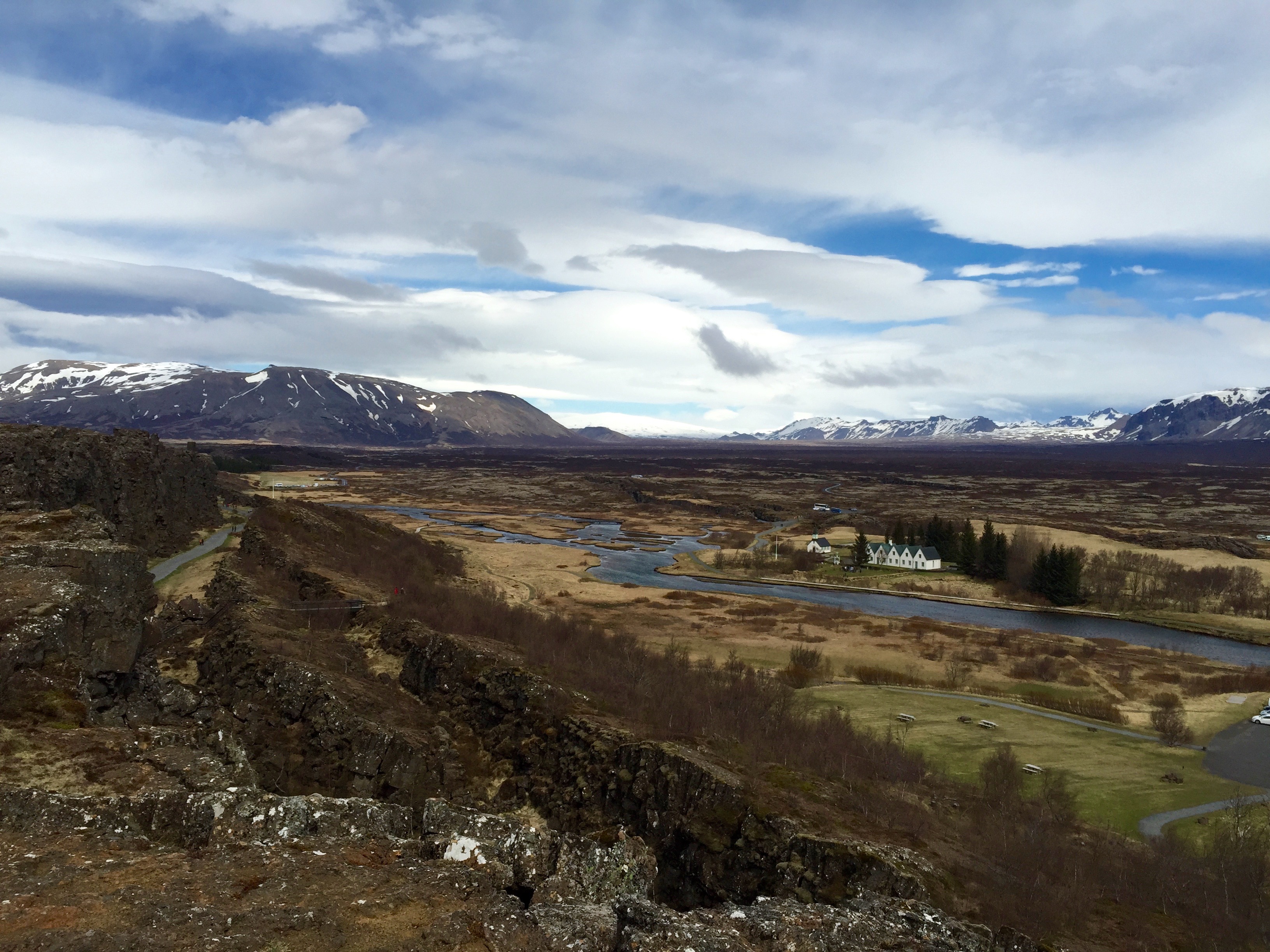
Beyond the third stop at Þingvellir, the route follows Kaldidalur north to Surtshellir, Iceland’s largest cave, and then across a seldom-traveled stretch to the south end of Arnarvatnsvegur, which will take me toward the north coast, where I will wend my way to Þingeyrar and the north coast.
I’m anticipating 6 or so additional stops along that long section north of Þingvellir, with a couple giving me a chance to rest for an hour or two. So far, the weather outlook is typical of this spring’s chilly temperatures, but nothing too unusual for Iceland!
More updates soon…


Leave a comment